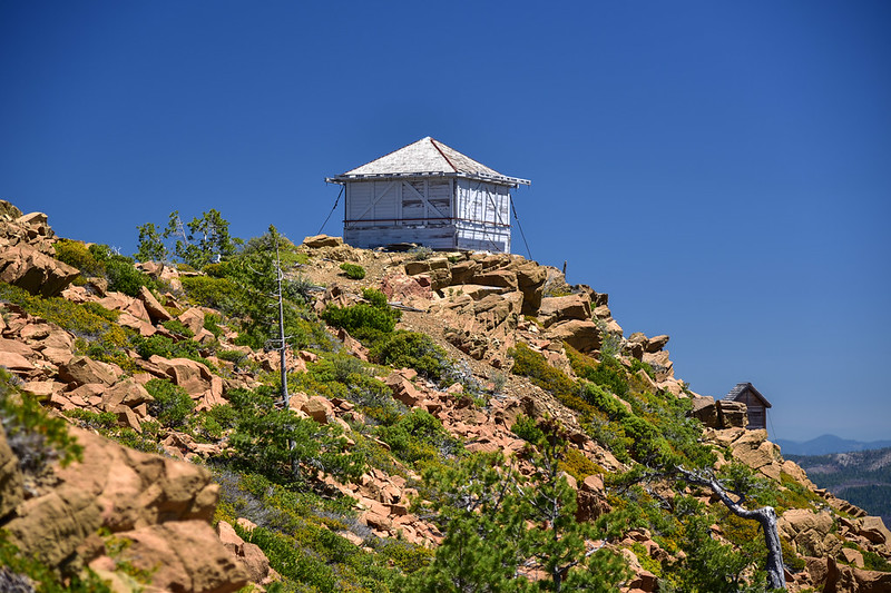
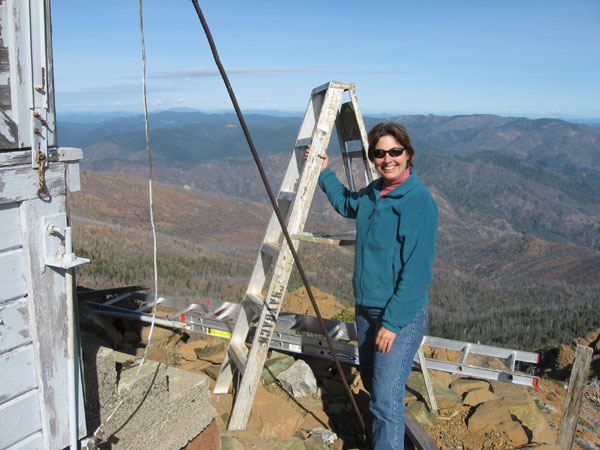
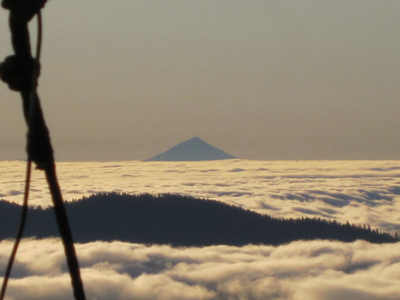
Located 10 miles WNW of Selma, Oregon, Pearsoll Peak is the highest point in the Kalmiopsis Wilderness. The lookout sits on a false summit several hundred yards east of the Wilderness Boundary, where a better view of the Illinois River Valley comes into clearer relief. The existing lookout replaced a cupola-style building in 1954, and was built from a kit that must have been in storage for a while. This very remote site has an enormous view: the Cascades stretch from Diamond Peak to Mount Shasta on the eastern horizon, while the Pacific Ocean is visible in seven distinct places to the west.

How Pearsoll Peak, a forgotten and remote site, got on the SMS radar
| Quick Facts | Pearsoll Peak Lookout |
|---|---|
| Agency | Rogue River–Siskiyou National Forest |
| District | Wild Rivers Ranger District |
| Elevation | 5,098 ft. (1,554 m.) |
| Year Built | 1954 (replaced cupola from 1920s) |
| Style | L-4 with outriggers |
| Major SMS Work Efforts | 1991, 2001, 2007, 2011-present |
| Season | June 1- September 30 |
| Location | 42.29900001°N, -123.84600001°W |
| Access | Extremely difficult. Advanced 4WD with moderately difficult hiking trail for the last 1.5 miles. |
| Additional Notes | Due to difficulty of access, this site requires experienced crew and regular check-ins. Weather conditions tend to be extreme (wind, heat, cold, rain). |
Once SMS and Ranger Randy Dunbar agreed that Sand Mountain should once again have a lookout—ideally a historic structure—the Society sent old-fashioned letters during the winter of 1989 to Forests and other agencies throughout the Region, asking whether anyone had an abandoned lookout they wished to dispose of. There were two affirmative responses: one was Whisky Peak on the Rogue River National Forest, and the other was Pearsoll Peak on the Siskiyou National Forest. At that time, the Siskiyou National Forest had its own helitack base and crew, and the Forest Archaeologist, Janet Joyer, told SMS that she hoped SMS would choose her lookout, but she offered to “provide helicopter support for removal of whichever lookout you take, even if it’s not ours.” This generous offer made a very big impression.
Early in the summer of 1989, Bill Joy and Don Allen set out to visit both lookout sites in person for the first time, first visiting Whisky Peak (a very dilapidated grange hall-style L-4, identical in vintage and style to the original Sand Mountain Lookout), and then Pearsoll Peak (a much newer, later-model L-4 lookout with a hip roof and outriggers that was in far better condition). Whisky Peak had a good gravel road and tough 0.8-mile hike, but the road to Pearsoll Peak was a whole different kettle of fish! Back then, with only a 2-wheel drive pickup, Don and Bill only made it about a mile above the Illinois River before they had to park and hike up and down the remaining 6.5 miles and 3,760 feet of elevation gain – up and down… and it was a hot day. Upon arriving at the lookout, they were struck by the superior condition of Pearsoll Peak Lookout. It needed work, but it was structurally sound in comparison, and – unlike Whisky Peak – still had most of its windows intact. Don and Bill were on the horns of a dilemma: take this lookout that was in much better shape but a different model than the one originally atop Sand Mountain, or the highly vandalized lookout at Whisky Peak that was of ideal design. They decided to take Whisky Peak and stay accurate to Sand Mountain’s original grange hall-style L-4.
When they announced their decision to Janet Joyer, who had kindly offered helicopter assistance regardless, she said “OK.” True to her word, she then coordinated with her colleague on the neighboring Rogue River National Forest, Jeff LaLande, and arranged the helicopter support to fly-out the salvaged and bundled components that were Whisky Peak Lookout.
One good turn deserves another
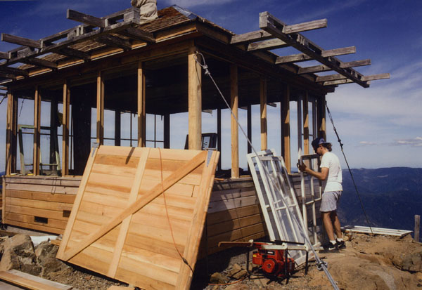
Owing to the kindness shown by Janet Joyer, Don and Bill decided to offer to restore Pearsoll Peak in place as soon as Sand Mountain Lookout was rebuilt. Don spent most of September and October of 1991 working with a combination of District personnel (primarily the late and very kind Cliff Phillips of Kerby, Oregon), and SMS members (especially Bill Joy and Greg Keil), plus a local gentleman from Selma named Carl Summers. The work accomplished included re-framing the west and south walls and rebuilding the shutters on those two sides. The team also replaced the roof, though Don warned that the outriggers would need to be replaced within about 10 years, which would mean pulling off the roof again. It was decided that – due to the short amount of time and a lack of funds –- the outriggers would need to be changed at a later date. Doug Newman and Richard Miller (both lookout legends) visited the site, and Doug very much enjoyed learning to glaze window glass (by that time of year it was getting so cold that a one burner propane stove had to be put on the floor under the glass being glazed to keep the putty workable).
Through the cold and rain, and even snow as work went into November, Don commuted most days using a USFS vehicle and spending nights in the USFS bunkhouse in Cave Junction. He also had a USFS radio. Don is known to say “I never would have even known that road could be driven had I not ridden up there with a Forest Service employee driving.”
At the end of that season, a USFS crew was sent up to help carry down tools. It had snowed about 2” overnight, and a large external frame generator loaned by the USFS needed to be carried down. Don’s USFS helpers said they would not help carry down the generator because it belonged to a different department. Don said “You’re kidding.”
“No, it belongs to Hydrology. Let them come get it.”
Don, fueled by anger and being at that time a healthy 28 years old, hoisted the generator (at least 150 lbs) onto his shoulders and hauled the generator the mile down the snowy trail to where the rigs were parked. 10 years later, Don constructed a stretcher to carry a similar-sized USFS generator down the trail between himself and a USFS employee.
Ten years later, the phone rings
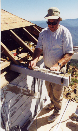
In 2001, the District called to say that the outriggers needed replacing (as had been anticipated back in 1991). The shutters had been left up over winter, snapping several outriggers under the weight of snow and doing damage to the shutters. SMS crews spent most of the summer of 2001 replacing the outriggers, which first required removal of the roofing and the bottom several courses of shiplap sheathing. During the intervening years, someone had also put fiberglass insulation in the attic space. This created a near-hazmat situation with mouse excrement and an active colony of mice living in the insulation. Donning respirators, rubber gloves, and Tyvek suits, SMS volunteers removed multiple large garbage bags full of insulation, mouse carcasses, and excrement, then sprayed bleach and water solution into the attic.
Don was working at Pearsoll Peak on September 11, 2001. “I was listening to Jefferson Public Radio, the local NPR affiliate, when Bob Edwards first delivered the report. At first I thought it was a mistake, but pretty soon my cell phone started to ring with friends calling to make sure I knew about it.”
The phone rings again
In 2008, the SMS received another call asking for help with Pearsoll Peak Lookout. During the prior winter, the north deck had given way and needed to be disassembled for public safety, but with the goal of re-using as much original fabric as possible. The original deck construction was documented, pieces catalogued, and salvaged material stored in the lookout.
A final call in 2011 and a lesson learned
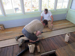
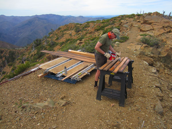
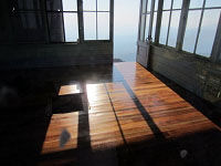
Numerous subsequent modifications by locals and visitors led to rapid decline of repairs made in 1991, and much work had to be re-done, including reconstructing all the shutters on the west and south sides, and the framing of the west wall. This came to a head in 2011 when the west window sill and some framing was damaged during a windstorm. A local person who no doubt meant well had put eye bolts into the window sill and latched the shutters down to the eye bolts with snap hooks. As the shutters fluttered in the wind, the eye bolts eventually tore the window sill out along the grain, which required completely re-framing the west wall. Later, similar damage revealed itself in the south wall. As a consequence, the interior siding had to be removed from the west wall. This provided the ideal opportunity to remove the tongue and groove fir flooring which was originally laid with the wrong orientation (parallel to the subfloor) and was trapped under the interior siding. So, while the interior siding was removed from the west wall, the floor was carefully pulled up and catalogued (so it could later be re-laid in the same sequence) and then hauled in bundles on SMS shoulders to the trailhead. The flooring was then conveyed to Portland where the paint was painstakingly removed by SMS volunteer Tim Nidever over the following winter using a steam process. In 2012, the Team hauled the flooring back to the lookout and re-laid it with the proper orientation. A clear varnish was used (as originally in 1954) to allow visitors to enjoy the beauty of the wood grain.
To make matters worse, a well-meaning visitor over-tightened the guy cable on the SW corner, causing the west and south walls to be pulled apart over winter (when the cable tightened due to cold). All of these unseen modifications that cause damage to the building led to a change in SMS policy. From that point on, SMS has opened the lookout each spring and lowered the shutters each Fall, and a set of interlocking iron bars was fabricated to clasp the shutters closed over winter. In addition, SMS took over all annual maintenance. Generally speaking, this has become the policy with all subsequent projects.
Climate change is felt… over and over
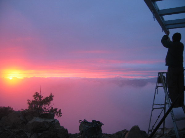
A series of fires prevented continuity of work at Pearsoll Peak, including the Labrador (2013), Chetco Bar (2017), and Klondike Fires (2018). Each closed access to the lookout off and on over several years. Several planned work efforts had to be rescheduled, and in the meantime, other projects were opened that had to be seen through. As a result, work at Pearsoll Peak has been unfortunately protracted. Given its distance from most of our membership and difficulty of access, it is more challenging to accomplish work there. All materials have to be hauled up and down a difficult trail, and normally team members need to get extended time off work to make a trip to Pearsoll worthwhile.
Pearsoll Peak is one of the most difficult-to-access sites on which the SMS works, and it has become progressively more challenging over the years. While some work was done on the road during a 2018 fire, it still takes about 1.5 hours to drive the last 7 miles in 4-low with a high-clearance vehicle. Because of its remoteness and distance to a hospital, extra care is required, and only experienced members of the SMS Historic Preservation Team are allowed to work at the site. Pearsoll is also characterized by extreme weather situations.
In 2002, the freshly painted lookout with its new outriggers and freshly sealed roof survived the infamous Biscuit Fire Complex of 2002. Had the dried-out roof and frayed outriggers been exposed during the fire, it’s hard to believe the building would have survived. Had we not had to defer the original outrigger repair until 2001 (due to lack of funds in 1991), the fresh finishes probably would not have been on the building when the fire took place.
It should be noted that Michael Keown (the District Archaeology Technician at the time) made the significant effort to drop the shutters in advance of the fire. In combination, the recent application of exterior finishes and Mr. Keown’s heroic effort to lower the shutters certainly saved the building. Burned conifers and brush were completely torched within 50 feet of the lookout, but the building — remarkably — survived Oregon’s biggest blaze in recorded history (nearly 500,000 acres).
The view from Pearsoll Peak was substantially altered in the aftermath of the 2002 fire.
News & Links
- Cheryl Hill, “Pearsoll Peak,” Every Lookout in Oregon, June 23, 2021.
- Lynda Demsher, “As It Was: National Register Lists Pearsoll Peak Lookout as Historic Place,” Jefferson Public Radio, March 21, 2018.
- Vincent DiFrancesco, “A Moonlit Hike to Pearsoll Peak,” Siskiyou Mountain Club, December 9, 2024.
- “Pearsoll Peak,” Peakbagger.
- “Pearsoll Peak Hike.” OregonHikers.org.